Bordered to the north by Mauritania, to the east by Mali, to the south by Guinea and Guinea-Bissau, and to the west by the Atlantic Ocean, Senegal covers an area of 196,712 km². Gambia forms an enclave within Senegal.
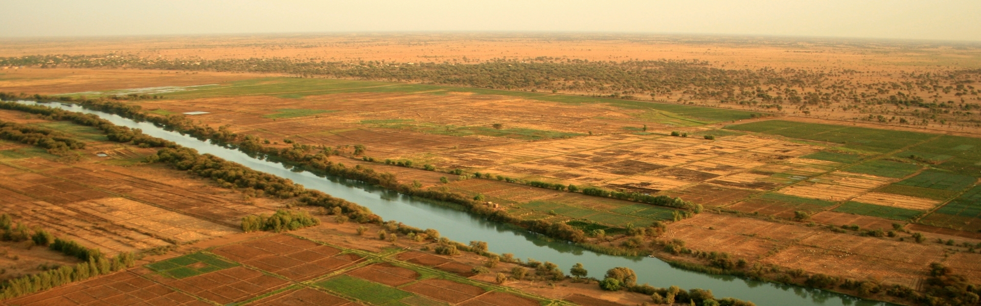
Thanks to its 1700 km-long river, the natural border between Senegal and Mauritania is quite clear. Originating in Guinea, the river also flows through Mali. The country’s second river is the Gambia, which flows through Bassari country on its way to Mauritania. Other rivers include the Casamance and the Sine-Saloum, both in their respective regions.
The territory is fairly flat, except for a few strategic locations such as the Ferlo desert in the center and the Senegal River basin in the north. There are also the Mamelles in Dakar, two hundred-meter-high hills, and the Bassari country in eastern Senegal, which heralds the first slopes of the Fouta Djalon massif.
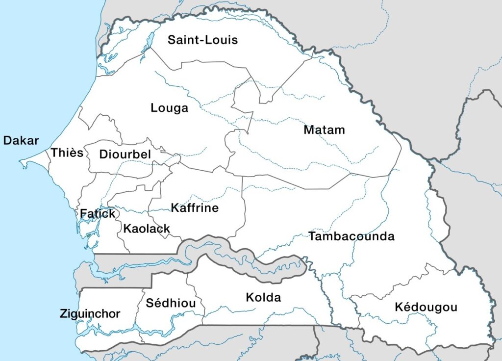
Senegal’s regions
Senegal’s climate is diverse, ranging from desert (Sahelian) in the north to tropical in the south. There are two distinct seasons:
- A dry season from November to May, with continental trade winds and mild temperatures.
- A wet season from June to October (paradoxically called “wintering”), with high temperatures and monsoon rains.
The west of the country experiences cooler temperatures than the east, which, along with the center, remains the hottest part of the country. From north to south, there are 5 main zones of tropical climate variation:
- Sahelian zone: between Rosso and Matam / Louga (increasing desertification, shrubs, a few baobabs, acacias).
- Sahelo-Sudanian zone: from Matam/Louga to Fatick (dry savannah, acacias, cheese trees, baobabs)
- The Sudanian zone: from Fatick to Haute-Casamance (denser savannah, sparse forests of baobabs, cheese trees, acacias and palms).
- The Sudano-Guinean zone: from Upper Casamance to Kolda (very dense savannahs and forests with cheese trees, baobabs, palms, filaos, roasters, etc.).
- The Guinean zone: southern Casamance (tropical rainforest).
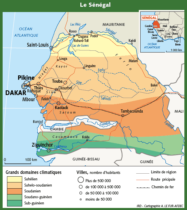
Senegal’s climatic zones
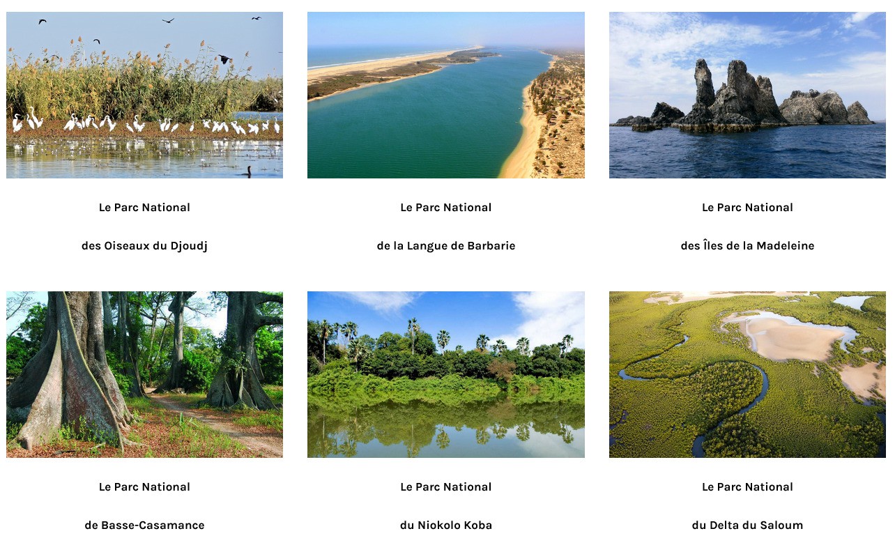
8% of Senegal’s territory is made up of protected areas. The country has 6 national parks: